AutoCAD Map 3D 2013
AutoCAD proved to be a useful software package during it's use in a three-month course dedicated to how it can be used in the GIS world. I first learned the importance of having a mapping standard within a firm and created a mock document which covered all aspects of enforcing a standard within the firm. After learning how to connect to feature sources and source drawings, I developed my skills in manipulating this data through symbolization, map outputs, queries, and reports.
CAD/GIS Mapping Standards
This deliverable contains a formal report detailing the map standards and procedures of mapping data management followed by Marotta Inc. Geospatial Technologies. Throughout the completion of this deliverable, I gained a basic practical familiarity with AutoCAD Map 3D and CAD mapping standards. Furthermore, I demonstrated my ability to create and assign object classes using AutoCAD, an important part of maintaining mapping standards. This deliverable demonstrated the importance of mapping standards so that consulting companies can produce quality products and operate in an organized fashion.
Feature Sources
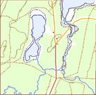
This deliverable contains a memo outlining the process and result of working with feature sources and map outputs in AutoCAD Map 3D 2013. This deliverable has allowed me to gain a practical familiarity with using raster images, connecting to features, styling images, and publishing a map book.
Source Drawing Queries/Reports
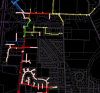
This deliverable contains a memo outlining the process and result of working with source drawing queries and reports in AutoCAD Map 3D 2013. This deliverable has allowed me to gain a practical familiarity with using source drawings, source drawing queries, and generating reports in Microsoft Excel from source drawing queries.
