Buffer/Overlay Analysis
This deliverable contains a formal report detailing the procedures and outcomes of an overlay analysis conducted for Niagara-on-the-Lake, Ontario. The goal of the overlay analysis was to determine possible areas at risk of water contamination and/or quality impairment as a result of wine production in the city. By completing this deliverable, many features available within the ArcGIS suite by ESRI were utilized. Thus, I was able to gain practical experience completing a full project with the use of commercial GIS software. The data utilized in this project are fictitious.
Maps (Appendices)
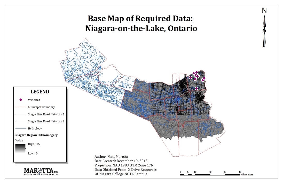
Appendix A - Base Map of Required Data
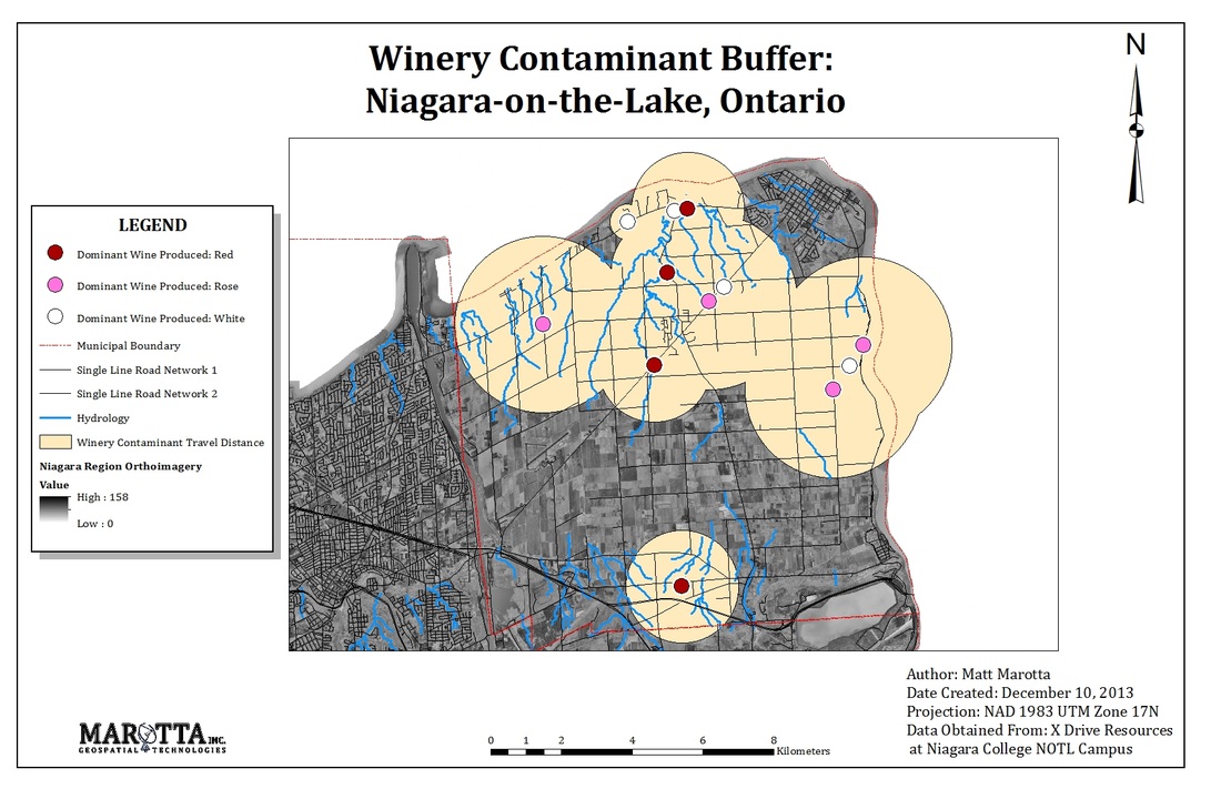
Appendix B - Winery Contaminant Buffer Map
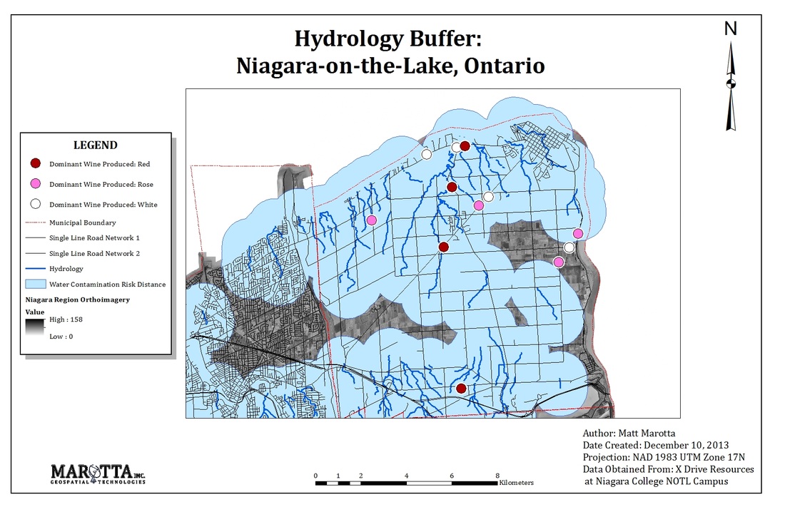
Appendix C - Hydrology Buffer Map
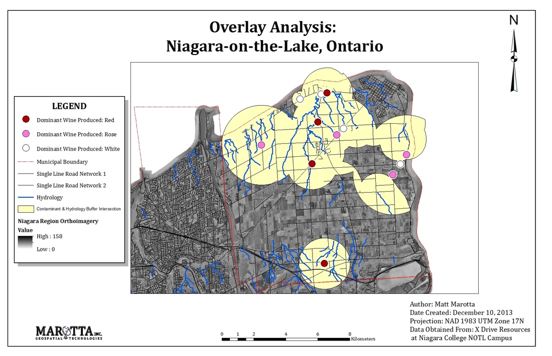
Appendix D - Overlay Analysis Map
