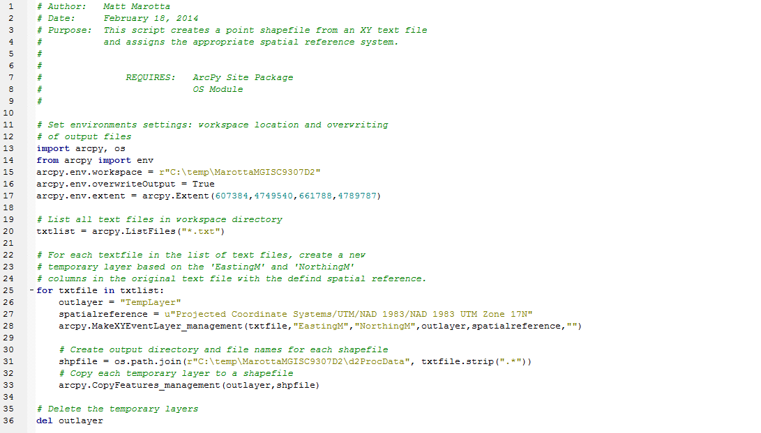
Creating a Shapefile from XY Data
This python script will convert all text files located in the work space directory into point shape files. The text files must have two columns to be converted appropriately: 'EastingM' and 'NorthingM'. The shape files can be opened in ArcMap and contain the appropriate spatial references and map extents.