Image Classification
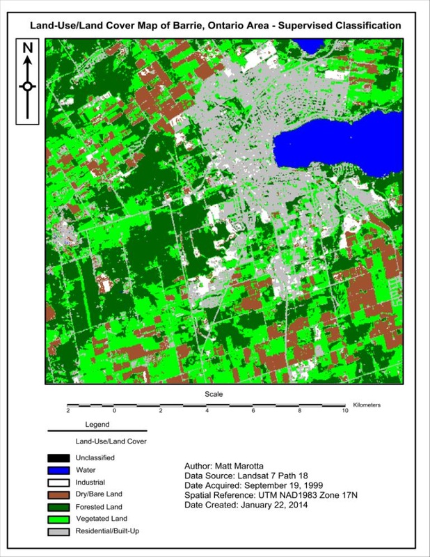
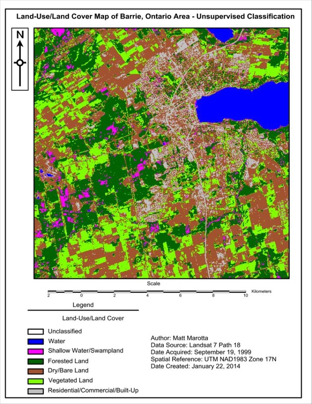
This deliverable contains a formal report in which I undertake the task of stacking multiple bands of remotely sensed imagery, creating a subset of the stacked images, and performing a supervised and unsupervised classification on the subset imagery. The final result consists of a map of the subset image and a map for each of the classifications. The report consists of a detailed methodology of how all tasks were carried out, including a statistical analysis for the training pixels that were gathered. The final section of the report discusses the different supervised classification algorithms as well as the differences between a supervised and unsupervised classification. This deliverable allowed me to gain practical experience utilizing the ERDAS Imagine image analysis and manipulation software package by applying remote sensing and digital image processing techniques.