Matt Marotta - GIS Professional
Home
About
Industry Experience
ArcGIS 10.x
>
Buffer/Overlay Analysis
Spatial Analyst Extension
Model Builder
Geostatistical Analyst Extension
Crime Analysis
AutoCAD Map 3D 2013
>
CAD/GIS Mapping Standards
Feature Sources
Source Drawing Queries/Reports
Remote Sensing/Digital Image Processing
>
Georeferencing & Change Detection
Image Classification
Principal Component Analysis
Geometric Correction
Python Scripting
>
Crime Analysis
Train Derailment Risk Assessment
Manipulating Street Addresses
Create Shapefile from XY Data
Manipulating an Attribute Table
Databases and Geodatabases
>
Database Creation
Database Use and Application
Database T-SQL
Geodatabase Design
Internet GIS Applications
Programming
>
HTML
Microsoft Visual Basic
Other Mapping Software
NC Thesis Project
Brock University Internship
Links/Resources
Contact
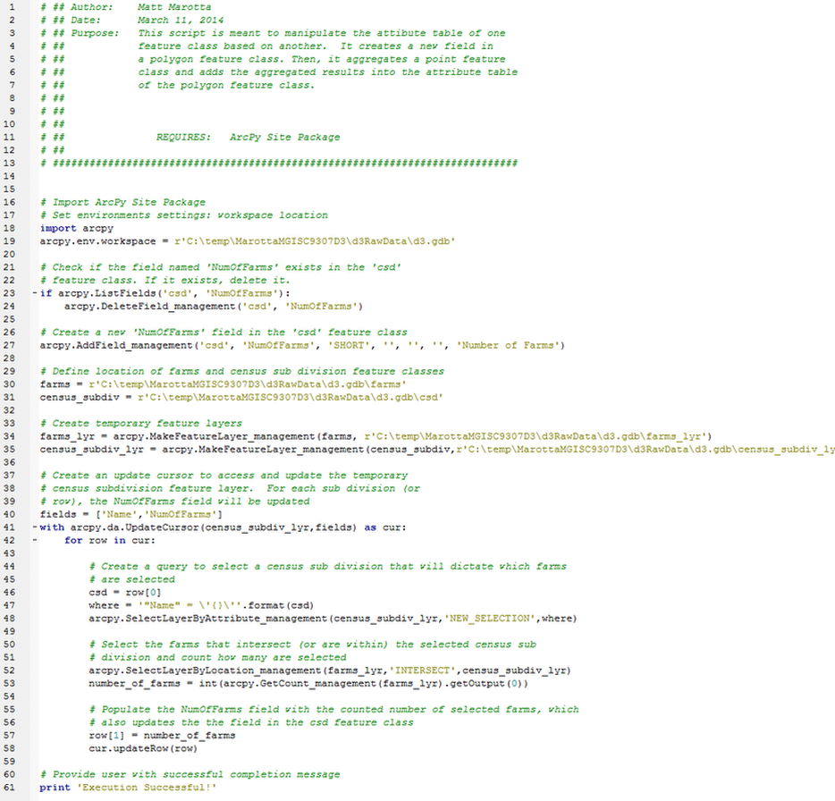
Manipulating an Attribute Table
This python script will create a new field in a polygon feature class, aggregate a point feature class, and add the aggregated result into the attribute table of the polygon feature class.