Geostatistical Analyst Extension
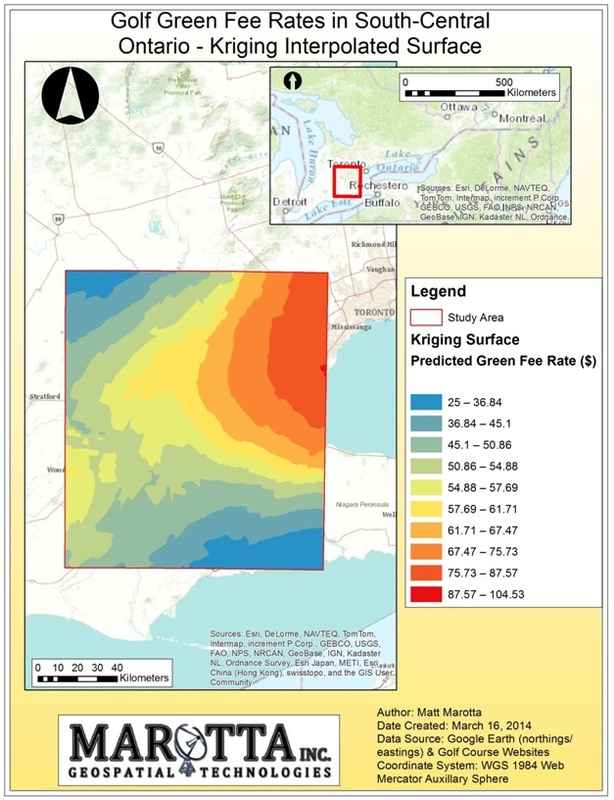
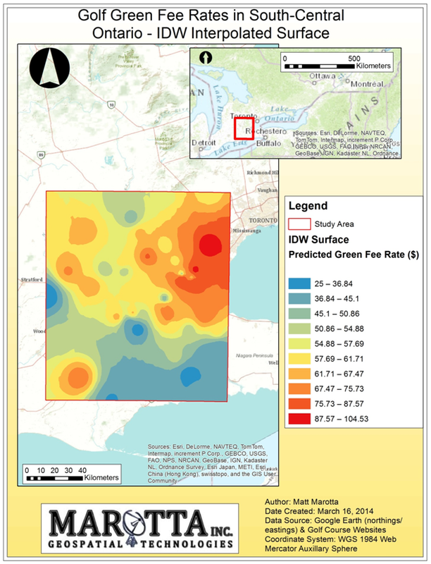
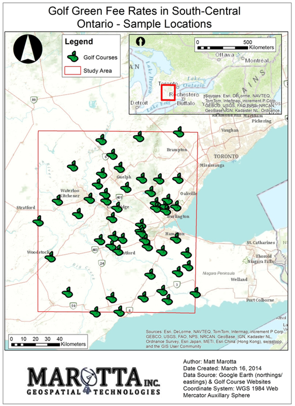
This deliverable contains a formal report in which I collect data and use ArcGIS Geostatistical Analyst to explore these data and produce a predicted surface. Using a sample of 52 golf courses in the study area, interpolated surfaces were produced showing predicted green fee rates anywhere within the study area. Two different interpolation techniques, Inverse Distance Weighted and Kriging, were utilized to produce the interpolated surfaces.