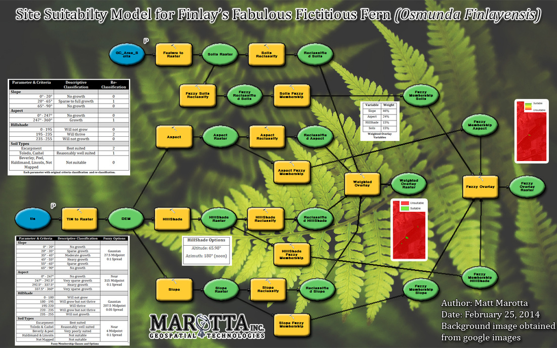
Model Builder
This assignment is a model produced to automate the processes used for the Spatial Analyst Extension assignment. It uses a Soils shapefile and TIN as input files. Using these two files, the end result is two raster files; one created from a weighted overlay and another created from a fuzzy overlay. Each output raster displays the suitability of the study area for re-introducing a fictitious fern species.